
Killaha Mountain [Sliabh Choill Atha]
Good walks are even better shared.
Overview
Killaha Mountain
Introduction
Killaha Mountain, or Sliabh Choill Atha, is a standout treasure in the beautiful Caha Mountains of Ireland. Rising to an elevation of 396 meters, this hill offers a delightful walking experience without challenging climbers to their limits—unless, of course, you lose your way!
Geology
The geology of Killaha is fascinating, primarily composed of slate and schist. As you wander through this ancient terrain, take a moment to ponder the glacial history that shaped these rugged hills. Each rock and crevice has a story to tell, often shouting, "You’d better appreciate my backstory!"
Routes
The most popular route begins in Kilgarvan, stretching approximately 10.5 km to the summit. Initially taking you through blissful valleys adorned with greenery, the ascent gradually leads you to the rocky outcrops of the peak. This route is moderate—it won't break a sweat but will help keep that heart pumping!
Summit Features
At the summit, hikers are greeted by a modest stone cairn—a reminder of fellow adventurers who have come before. It isn't quite a viewing platform, but it does the job quite well for an epic selfie!
Views
The splendid views from the top are the cherry on the cake. You can witness the sweeping landscapes of the Caha Mountains and the glistening waters of Kenmare Bay. Plan your ascent during the spring or early autumn to experience the stunning colours that nature has to offer.
Hazards
As with any mountain, there are hazards present. One must remain vigilant as the weather can be moody, changing faster than a teenager’s mind. Additionally, while the terrain is generally manageable, some boggy patches may test the sturdiness of your footwear. Bring some extra socks, just in case!
Access
Access to Killaha Mountain is quite simple. The nearest parking is available in Kilgarvan, approximately 6 km from the trailhead. Just be sure to arrive early to claim your spot. Public transport can help get you to Kilgarvan, but plan accordingly as service may vary.
Nearby Facilities
In Kilgarvan, you can find local cafes and shops to refuel your energy before or after embarking on your hike. It’s a brilliant little village, worthy of exploration!
Conclusion
In summary, Killaha Mountain offers a perfect blend of natural beauty, moderate hiking challenges, and captivating views. Whether you are a seasoned hiker or a casual walker, this gem in the Caha Mountains will leave you with memories to treasure—and possibly a few fantastic photos!
Happy hiking! Hope your boots hold up!
Explore routes near Killaha Mountain [Sliabh Choill Atha]
Public walks starting within 80 km of this hill. Nearby does not mean a route reaches the summit; check its map and access before setting out.
No public routes are currently listed within 80 km of Killaha Mountain [Sliabh Choill Atha] on Walkmates. This does not mean there are no paths here. Explore the map and check local access information before planning a walk.
Route planning notes
These notes describe possible approaches, not verified navigable routes or permission to cross land. Check current paths, local access rules and conditions before setting out.
Kilgarvan to Killaha
Starting from Kilgarvan, this route meanders through lush valleys and ascends gradually to the summit of Killaha. A perfect way to soak up the scenery without sweating buckets.
Make a day of it, together
Find someone to share the walk with, or organise a day out along a route you like.
Hill facts and local notes
Classifications
Elevation
405m
1,329 ft
Prominence
103m
Coordinates
51.8441, -9.5896
V905669
OS Map
85
At the Summit
The summit features a small stone cairn, which, while not exactly the Eiffel Tower, is a great spot for a photo op.
Terrain & Geology
Composed primarily of slate and schist, Killaha Mountain showcases the stunning geological history typical of the Caha range. This area is marked by glaciated valleys and rugged terrain that tell tales of ancient ice flows.
Views & Scenery
From the summit, one can see the majestic gear of the surrounding Caha Mountains, the shimmering waters of Kenmare Bay, and on a clear day, the distant mountains of Kerry.
History & Heritage
Name Origin
Sliabh Choill Atha translates to 'mountain of the wood of the ford', hinting at the area's pastoral and wooded history.
Historical Significance
The mountain holds cultural significance in local folklore, often mentioned in tales of spirits and the ancient past.
Getting There & Facilities
Check current local access restrictions, parking rules and transport timetables before travelling. These notes do not confirm public access to the summit.
Parking
There is limited parking available in Kilgarvan, about 6 km from the base of Killaha Mountain. Be sure to arrive early to secure a space!
Public Transport
Buses run from Killarney to Kilgarvan, but service can be infrequent, so check the schedule ahead of time.
Nearby Facilities
While there are no facilities directly on the mountain, Kilgarvan offers a few local cafes and shops where you can grab a bite before or after your trek.
Safety Information
Known Hazards
- Be cautious of changing weather; conditions can shift rapidly. The boggy areas can be treacherous, don’t be surprised if you find your boots end up looking for a swim.
General Safety Tips
- Check weather conditions before setting out
- Carry appropriate clothing and equipment
- Let someone know your planned route
- Take a map, compass, and GPS device
- Carry emergency supplies: food, water, first aid kit, torch
Hills
Some common questions about the hills answered
Are there group walks up Killaha Mountain [Sliabh Choill Atha]?
Many walkers use Walkmates to join or organise walks with others. You can check for group walks around Killaha Mountain [Sliabh Choill Atha] through the maps
Are there other walkers around Killaha Mountain [Sliabh Choill Atha]?
Activity varies by location and time, but Walkmates lets you see whether others have shared walks or shown interest in this area. Find other people through the walking friends search walking friends for Killaha Mountain [Sliabh Choill Atha] search or of course create your own walk for Killaha Mountain [Sliabh Choill Atha]
Can I organise a walk to Killaha Mountain [Sliabh Choill Atha]?
Yes. If there aren’t any walks listed already, you can create a walk and make it available for others to join.
If you're signed up to Walkmates, you can create a walk to Killaha Mountain [Sliabh Choill Atha].
How do I find a walk up this hill?
There are often multiple ways to walk this hill, depending on experience and route preference. Walkmates helps you explore walks and routes that others have shared.
Can I suggest a new route up Killaha Mountain [Sliabh Choill Atha]?
Yes. You can suggest or create routes to share with others. Walkmates focuses on the social side of walking, so routes are used to help people organise walks and explore areas together, rather than as detailed navigation tools or route libraries.
Other uses really appreciate knowledgeable walkers sharing their routes. Share your favourite route to Killaha Mountain [Sliabh Choill Atha] here
The is an error or something incorrect about this hill. How do I let you know?
We always strive to keep the information on Walkmates as accurate as possible. If you find an error, please let us know through the contact form and we'll aim to correct it as quickly as possible
Community Discussion
Comments
Location
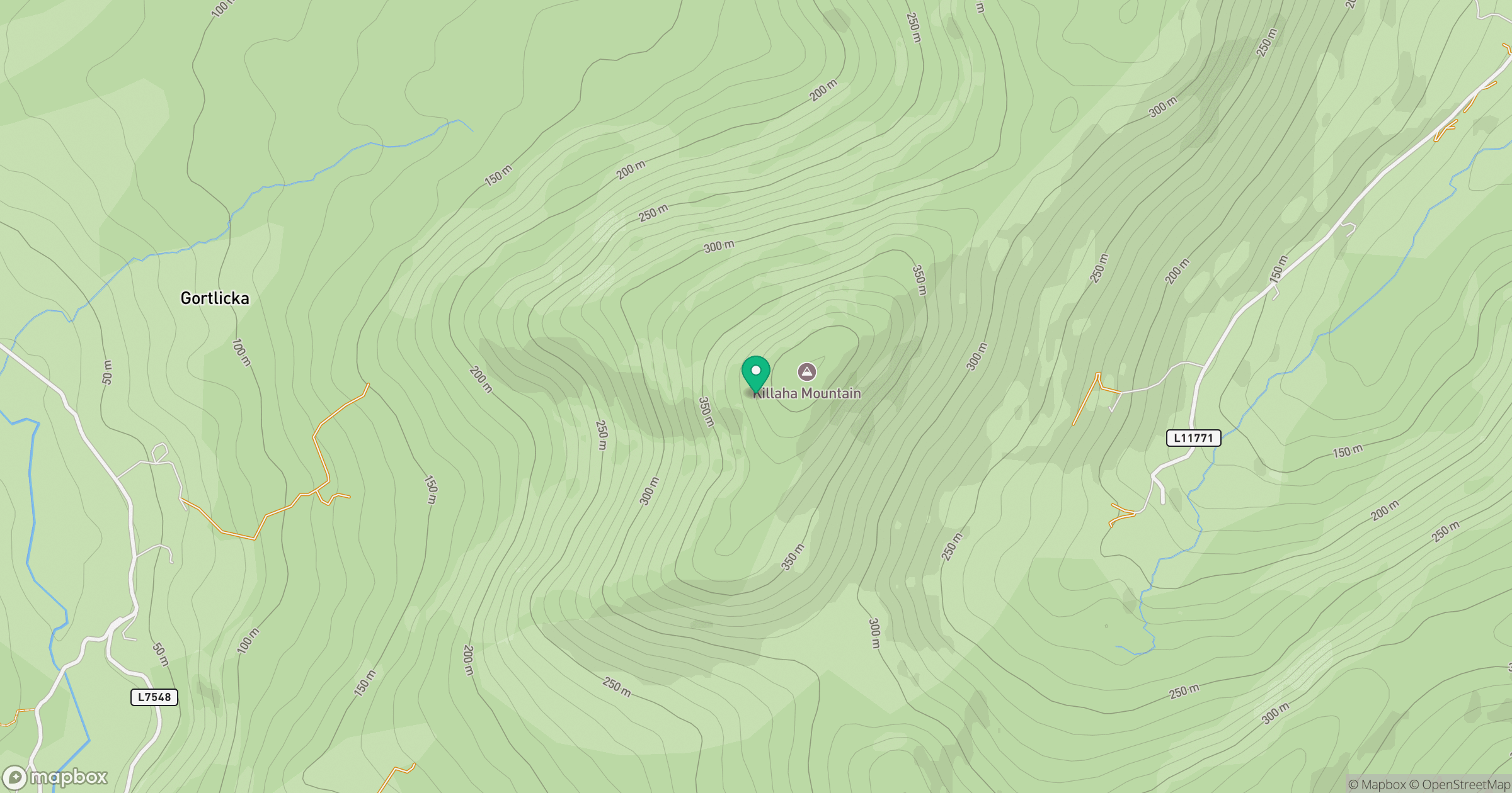
Grid reference: V905669
View on OpenStreetMapOpens a map in a new tab, centred on the hill.
Hills within 30 km
Straight-line distance, not a walking route or confirmation of access.
Torc Mountain
535m
Carrauntoohil
1,039m
Knockeirka [Cnoc Adhairce]
426m
Knocknagorraveela [Cnoc na gCorrmhiolta]
507m
Inchimore
256m
No comments yet. Be the first.